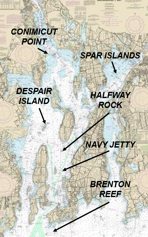
Narragansett Bay Hazards
Fish Trap Areas
Things to note
- Large areas authorized by DEM for fish traps in the bay and in southern RI waters
- DEM latest interactive permit map
- Most traps in the bay are for aquaculture (oysters) and are poorly marked
- Traps can be barrels with cable between barrels just below waterline (offshore)
- Markings at edge of traps have buoys with flags, but are difficult to see, especially in heavy weather
- Several located around Narragansett Bay, and several located south of the bay offshore and in south county aquaculture farms
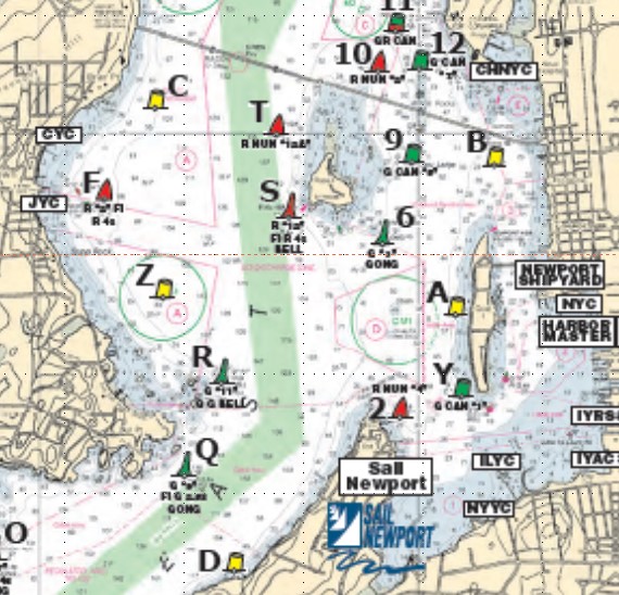
Bay Traps
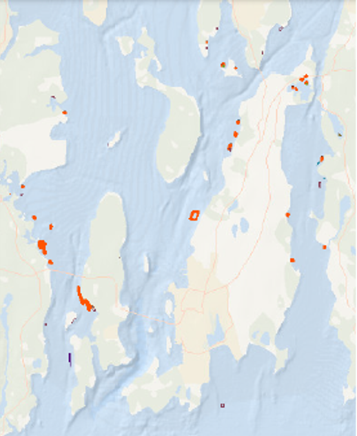
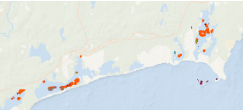
South County Traps
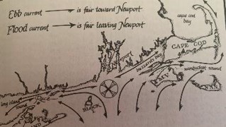
Currents
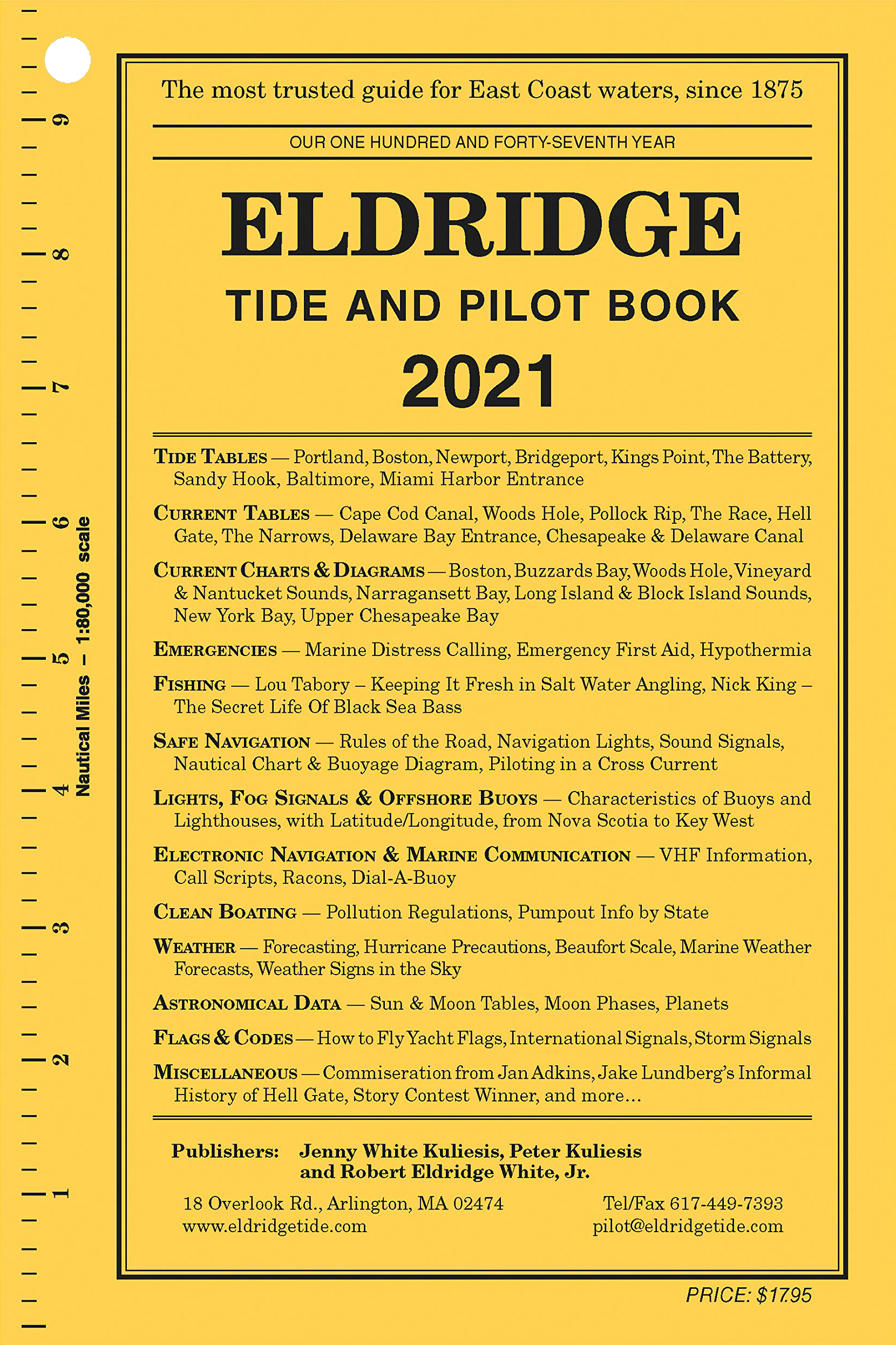
Eldridge Tide and Pilot Book
- Outstanding local resource of info on Narragansett Bay and beyond to much of east coast
- Tide Tables
- Current Tables and Diagrams
- Safe Navigation
- Lights, Signals, and Buoys
- Communication protocols
- Astronomical Data (sun/moon/planets)
- Flags & Codes
- Miscellaneous useful info
Continuing your boating education
Many local resources exist for various levels of education on various boating topics.