by R.J. HEIM, NBC 10 NEWS
Thu, May 11th 2023, 9:44 PM EDT
NEWPORT, R.I. (WJAR) — The Newport stopover of the around-the-world Ocean Race runs now through next weekend, with the events based in Fort Adams.
If you plan on boating to catch some of the action, there’ll be restrictions on where you can go on the water. Here’s how you can prepare:
It was relatively quiet in Newport Harbor and on Narragansett Bay on Thursday, but that will all change this and next weekend as the first big event of the boating season comes to the Ocean State.
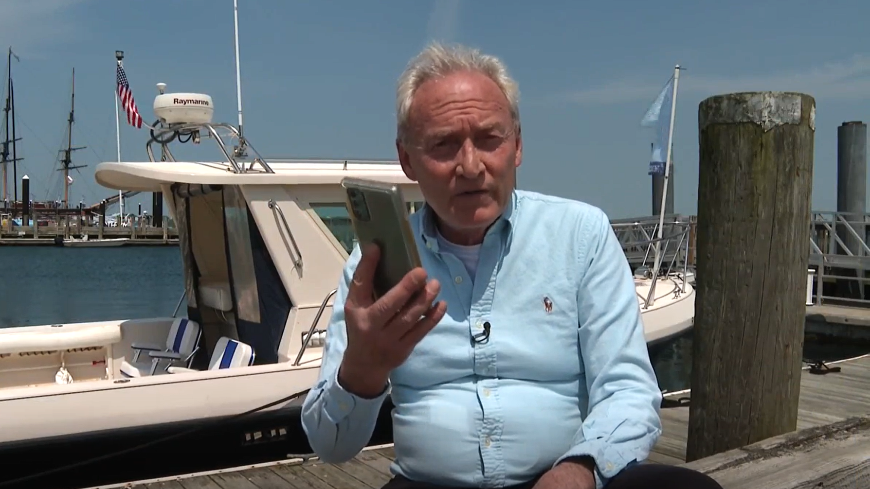
“A lot of time that the accidents happen, it’s not necessarily the spectators at an event. But boaters crossing through an event,” said Sean McNeill of Sail Newport and The Ocean Race Stopover Spokesperson.
The nonprofit Better Bay Alliance has now officially launched its website with “Live Chart” — the first of its kind in the country that maps geographic waterways in and around Rhode Island so that pleasure craft can safely enjoy their boating time.
“Our first effort was to create a master calendar of all events happening on Rhode Island waters, to have it all in one place,” said Mollie Frazer Williams, who is on the board for the Better Bay Alliance.
This first version of “Live Chart” was created after boating enthusiasts lost their friend Sandra Tartaglino in August, 2019, while she was racing in the New England 100 Regatta and was broadsided and run over by a 28-foot cabin cruise captained by Frank Teixeira of Portsmouth.
While the current Version 1 of the program is on a mobile-friendly website, the ultimate goal is an app that will have, among other items, real time boat traffic data.
“Let’s say there’s dense fog,” said Frazer Williams. “They got caught in a patch of fog. They could actually tap a button that reports that, so other boaters could see that. What activity is around them at all times.”
Picking any date on the website’s calendar in the “Live Chart” section, for example, mid-July, show how busy Narragansett Bay will be.
Every boater interested in safety, whether the captain, crew, or passengers, are encouraged by the Better Bay Alliance to check “Live Chart” before heading out. It just may save a life.
Related Article
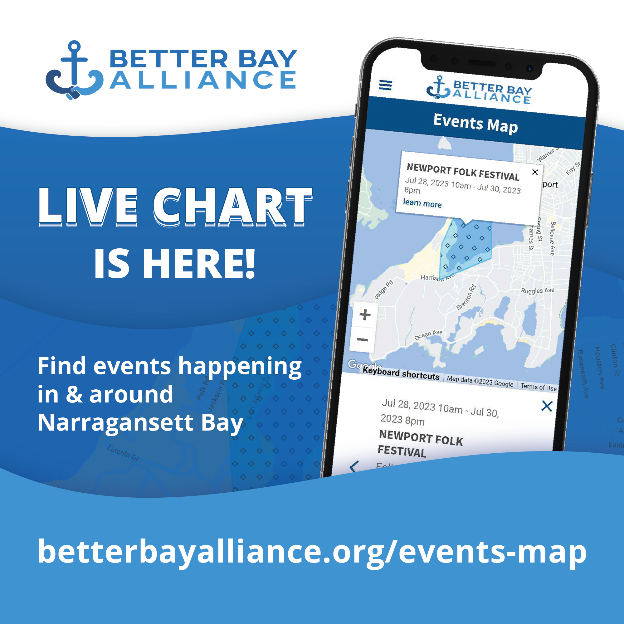
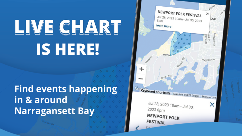
We have exciting news! If you sail, powerboat, kayak/SUP, float, or swim in our beautiful bay, LIVE CHART is now available to keep you current on the daily activities in Narragansett Bay and beyond. RI waters are incredibly busy. And awareness is your key to safety. Comprehensive interactive daily bay information!!